Doppler Lidar
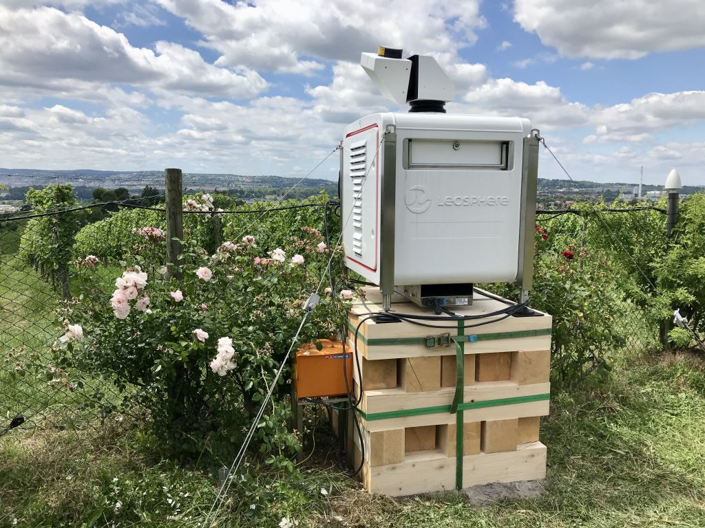
Doppler lidar systems (Fig. 1, Fig. 2) are active remote sensing instruments for the determination of wind from aerosol backscatter. Additionally, information about the stratification, e.g. the boundary layer height or cloud base heights, can be derived.
A Doppler lidar system consists of a laser transceiver, which emits laser light to the atmospheric volume under consideration. Usually, pulsed lasers with an infrared wavelength between 1.5 µm and 2 µm are used, creating invisible and eye-safe laser radiation. Due aerosol scattering, some of the laser light is returned to the instrument and measured. The wavelength of the scattered and returned light is Doppler shifted depending on the scatterer's velocity in the direction of the laser beam. Since the aerosol particles are transported with the wind, the wind velocity in the beam direction can thus be determined from the measured Doppler shift. The distance from the instrument is determined using the travel time of light between emission and measurement, enabling range resolved wind measurements.
The Doppler measurements provide only the wind velocity in the direction of the laser beam (radial velocity). To determine 3D wind vectors (Fig. 3), measurements in different directions are necessary. The beam can be steered in different directions using a one-axis scanner (e.g. a fixed prism) or using two-axis scanners (see WLS200s in Fig. 1 or WindTracer HYB in Fig. 2).
The coordinated operation of multiple Doppler lidars allows dual-Doppler and multi-Doppler applications, where the wind vectors are determined at specific locations from intersecting measurements of different Doppler lidars. This allows 2D wind measurements over larger areas (see Fig. 4) or at virtual towers.
KITcube operates in sum ten ground based Doppler lidar systems and one airborne Doppler lidar.
Three small Doppler lidar systems with 1-axis scanners for the determination of low-level vertical wind profiles:
-
Leosphere WLS7 / Windcube 2.1 (max. 350 m height)
-
Leosphere WLS8 (max. 600 m height)
Five medium Doppler lidar systems with 2-axis scanners capable of probing the entire atmospheric boundary layer:
-
Leosphere WLS200s
Two powerful Doppler lidar systems with 2-axis scanners enabling more than 10 km range:
-
Lockheed Martin WindTracer HYB
-
Lockheed Martin WindTracer WTX
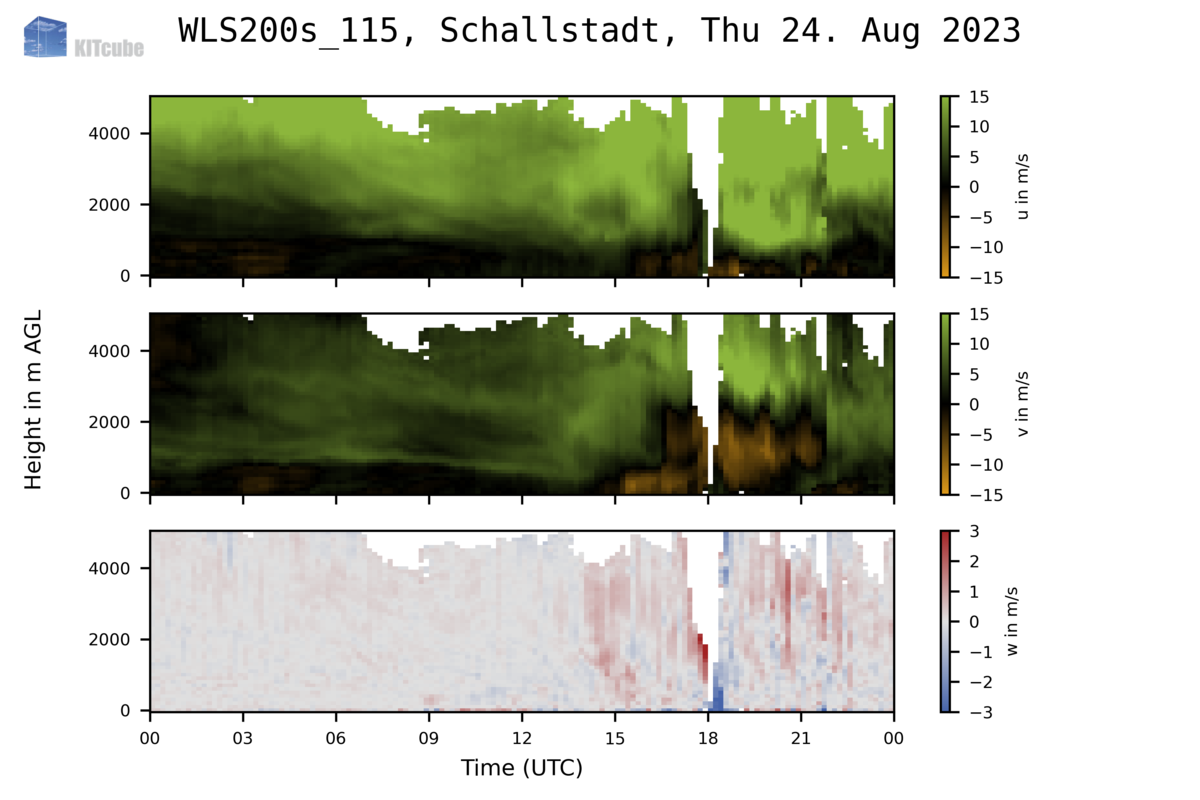
To enable the processing of data from multiple types of Doppler lidar systems we have developed the Atmospheric profile processing toolKIT (AtmoProKIT). The software calculates quality controlled vertical wind profiles from heterogeneous Doppler lidar data, i.e. independent of the system type, data acquisition settings or the scan pattern applied. Fig. 3 shows wind profiles processed with AtmoProKIT.
More information:
Presentation Probing the atmospheric boundary layer with Doppler lidar
Doppler lidar wind profile retrieval software AtmoProKIT.