DIAL ‒ Lidar system for water vapour profiles
In addition to its property as a greenhouse gas, water vapor is the transport medium for energy in the atmosphere. The heat used in the evaporation of water is released again during the condensation of water vapour, e.g. during cloud formation. This latent heat can be transported over thousands of kilometres and cause extreme weather events with large amounts of precipitation. The maximum content of water vapor in the atmosphere depends primarily on the temperature. Significantly more water vapour can be present at ground level and in warmer regions (tropics) than at higher altitudes and in polar regions. Due to climate change with higher temperatures, extreme events can therefore increase in intensity.
Water vapor in the atmosphere is subject to great variability both horizontally and vertically. Precise knowledge about the distribution and transport of water vapor in the atmosphere is therefore an essential basis for weather forecasting and climate research. While the measurement at ground level with in situ methods e.g. with hygrometers or psychrometers is easy to carry out, the measurement at greater height above the ground level is difficult. Balloon-borne radiosondes can measure the humidity only in larger temporal intervals.
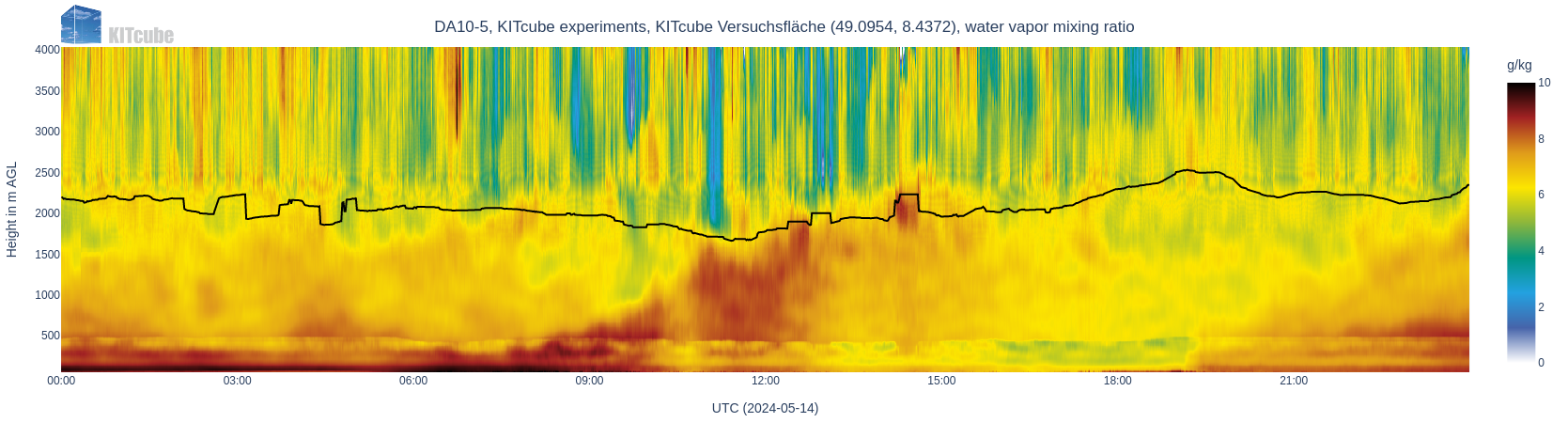
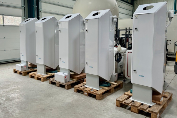
In early 2024, the KITcube measurement capabilities were extended by five innovative Differential Absorption Lidar (DIAL) water vapour profilers, which measure the vertical distribution of water vapour in the lower four kilometers of the atmosphere. The DIAL measurement method uses two slightly different wavelengths which are sent vertically into the atmosphere, from which only one is absorbed by the water molecules. The amount of water vapor is determined from the signal difference of the backscattered laser light received by the same device. The associated measurement height results from the runtime of the laser light.
The following figure shows the water vapour measurements from May 14th, 2024. The great variability of the water vapor concentration can be clearly seen both with the height and with the time. From around 08:30 UTC, the water evaporated from the ground, mainly by plants, is transported higher and higher by convection and reaches a height of 2000 m at 12:00 UTC. Smaller clouds can be seen at 14:30 UTC at a height of approx. 2200 m due to high water vapor concentrations. This moist layer reaching up to there is the atmospheric boundary layer, which is in direct exchange with the ground surface. The black line in the figure represents the maximum height up to which reliable measurements are possible. A weakness of the firmware used at that time is shown in the transition area of two measurement zones of the device at a height of approximately 500 m.