
Field campaigns
The mobile KITcube platform is regularly used in field campaigns all over the world. Most campaigns are organized in collaboration with partner institutions covering diverse areas of research. Topics range from the understanding of hydrological circulations and challenges regarding global warming, local convective cells and severe winds to validation of regional climate models. Interdisciplinary projects investigate impacts of population increase, urbanization and economic growth on respiratory disease, agriculture, and formation of clouds and precipitation during the west-African summer monsoon. Therefore, KITcube is operated at various locations and continents.
![]() NAWDIC (2025/26)
NAWDIC (2025/26)
NAWDIC is a new initiative for an international field campaign focusing on mid-latitude atmospheric dynamics with the aim to provide detailed observations for improving the understanding and modelling of the mesoscale tropopause structure, the dry intrusion air stream - PBL interaction, and their relation to high impact weather in the North Atlantic region in winter. NAWDIC consists of several components, which are planned as stand-alone measurement campaigns by different groups, but will benefit from synergies under the umbrella of NAWDIC.
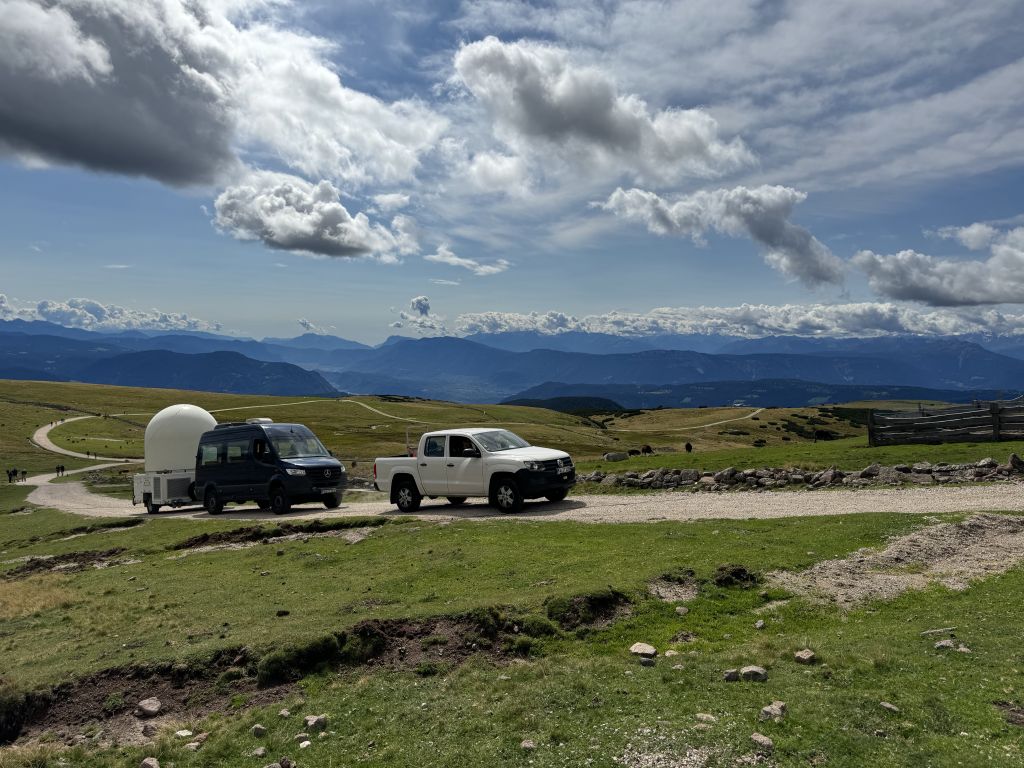
![]() TEAMx (2025)
TEAMx (2025)
Atmospheric processes specific to mountainous regions heavily affect the exchange of momentum, heat and mass between the Earth’s surface and the atmosphere. TEAMx is an international research programme that aims at improving our understanding of these processes. The field campaign will focus on the European Alps, with large-scale deployment of micrometeorological instrumentation, ground-based profiling instruments and airborne sensors.
|
![]() Swabian MOSES 2.0 + Lift (2023)
Swabian MOSES 2.0 + Lift (2023)
The Swabian MOSES 2.0 campaign was conducted within the framework of the MOSES observing system of the Helmholtz Association. It comprises highly flexible and mobile observation modules which are specifically designed to investigate the interactions of short-term events and long-term trends across Earth compartments. The focus of the 2023 campaign was the initiation of thunderstorms and severe precipitation events.
 |
 |
 |
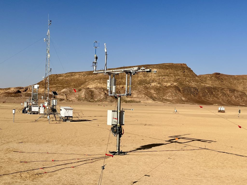
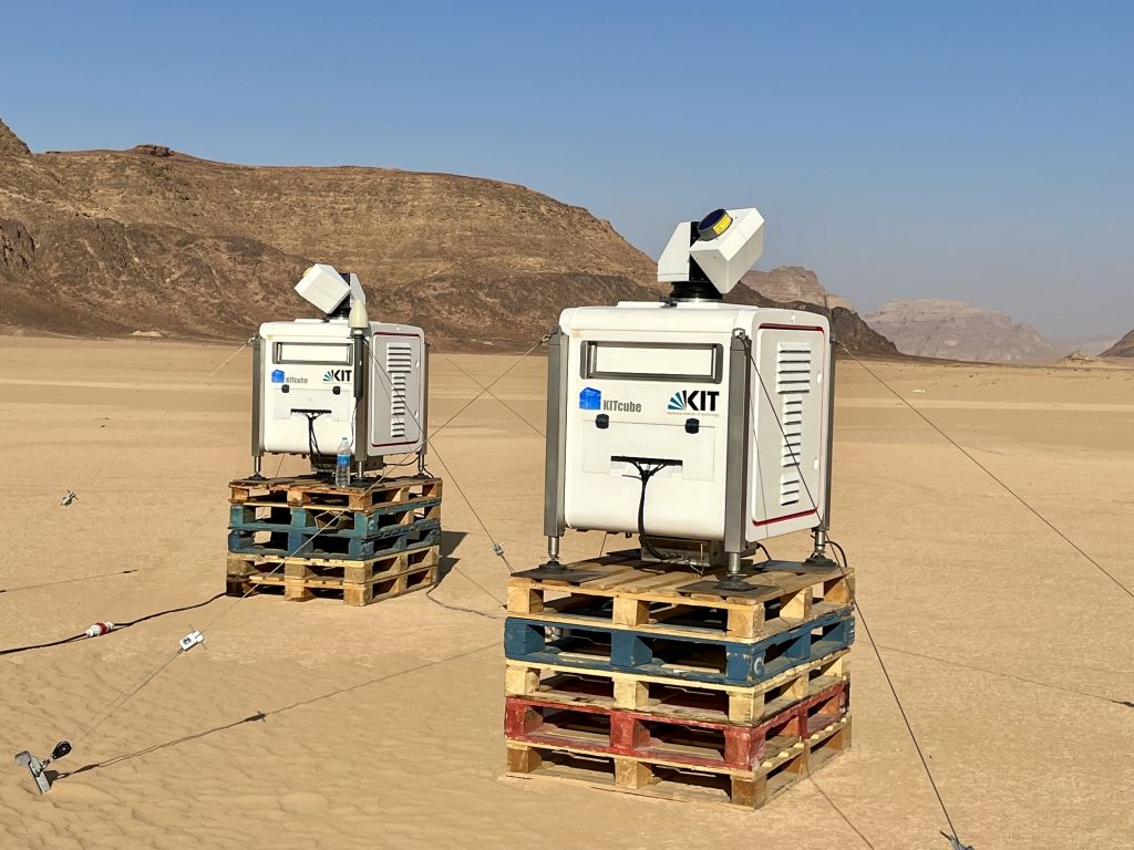
J-WADI J-WADI (2022)
A comprehensive mineral dust measurement campaign is planned to be conducted in southern Jordan in September 2022 with the goal to better understand the particle size – including giant mineral dust particles – and mineralogical composition of emitted dust and their dependence on the parent soil and meteorological conditions. Understanding the mineral dust emission process is a key prerequisite to quantifying the regional and global impacts of dust on air quality, health, economy, and not least on weather and climate. The campaign is co-organized between the Helmholtz Young Investigator Group “Mineral Dust” at KIT IMK-TRO (PI M. Klose) and the ERC Consolidator Grant “FRAGMENT” at the Barcelona Supercomputing Center (PI C. Pérez García-Pando) with participation from several other research institutes, e.g. University of Jordan (Jordan), TU Darmstadt (Germany), IDAEA-CSIC (Spain), INRAE (France), DRI (US).
 |
 |
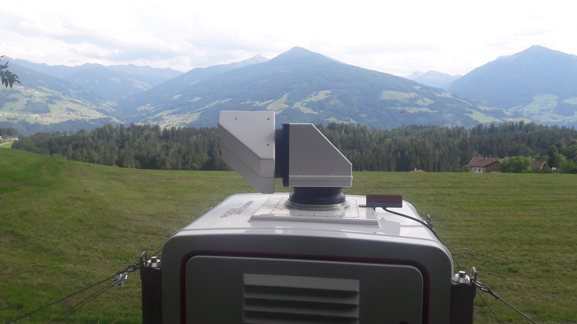
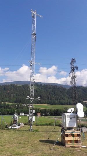
![]() TEAMx PreExperiment (2022)
TEAMx PreExperiment (2022)
To prepare the TEAMx campaign 2025, four Doppler lidar systems and the dual frequency FMCW cloud radar were operated in the Inn valley in summer 2022. Local flows were observed in order to optimize the measurement strategy and instrumentation.
![]() Swabian MOSES (2021)
Swabian MOSES (2021)
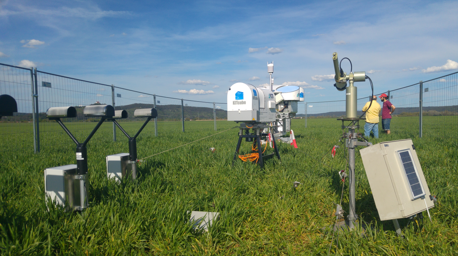
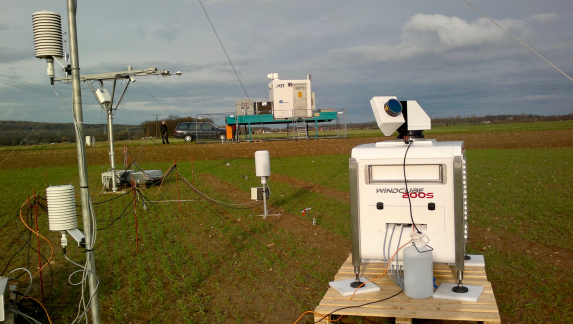
The MOSES campaign Swabian MOSES started on May 5th, 2021. Swabian MOSES was a hydrometeorological campaign from May to September 2021. Measurements were carried out in the Neckar valley and the Swabian Jura. The focus was on two hydrometeorological extremes with relevance not only for the area under investigation, but also for local convective cells (thunderstorms) in combination with heavy rain and hail, as well as heat waves and the associated droughts.
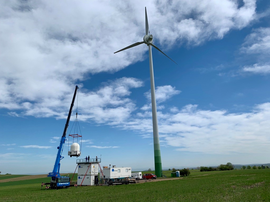
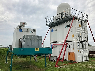
The Swabian MOSES campaign was coordinated by IMK-TRO. It was a collaboration of in sum nine institutions: Helmholtz centres KIT, GFZ, UFZ, FZJ, as well as die Eberhard Karls Universität Tübingen, Universität Hohenheim, Technische Universität Braunschweig (TU), Deutscher Wetterdienst (DWD) and German Aerospace center (DLR). The KITcube main sites were in Rottenburg am Neckar and Nürtingen (X-band radar) in the Neckartal valley (see photos).
 |
 |
KITcube main sites Rottenburg am Neckar (left) and Nürtingen (right) during the Swabian MOSES campaign 2021 in the Neckar valley and on the Schwabian jura south western Germany. Left: KITcube disdrometer (l), photometer (r), micro wave radiometer, FMCW cloud radar (m), and a Doppler lidar (not visible). Right: Installation of the KITcube X-band radar in Nürtingen on April 19th, 2021.
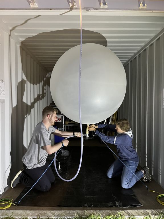
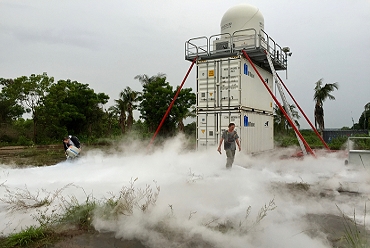
CROSSINN (2019)
From the beginning of July, KITcube was operated in the CROSSINN campaign. To investigate cross-valley flows, Leosphere WLS200s Doppler lidars were installed on two opposed slopes of the alpine Inn valley in Austria. The WLS200 were connected with a third WLS200s at the valley ground via direct link telemetry. The WLS200s at the valley floor conducts the real-time instrument control to achieve coordinated scans. Further important instruments during CROSSINN were the microwave radiometer HATPRO G4, the ceilometer CHM15, radiosondes, and a new 4-sensor-vis/IR-cloudcamera system.
 |
 |
![]() MOSES Müglitz (2019).
MOSES Müglitz (2019).
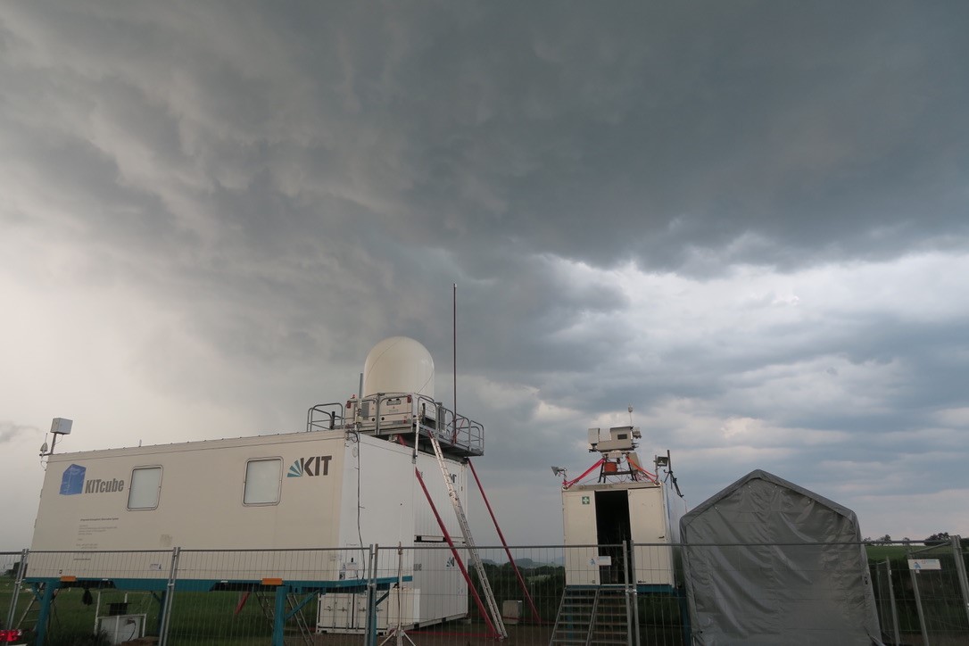
Within the Helmholtz project MOSES (Modular Observation Solutions for Earth Systems), IMK-TRO was part of the impact chain "Hydrological Extremes" and conducted the field campaign Müglitz 2019 in collaboration with the MOSES partners GFZ, UFZ, und FZJ . KITcube was deployed in the eastern Erzgebirge (Saxony) from Mai to Juli 2019. Heavy precipitation events were investigated in six intensive observation periods from the initiation to the impact. Continuous rain for several days as well as heavy rain due to high-reaching convection were observed.
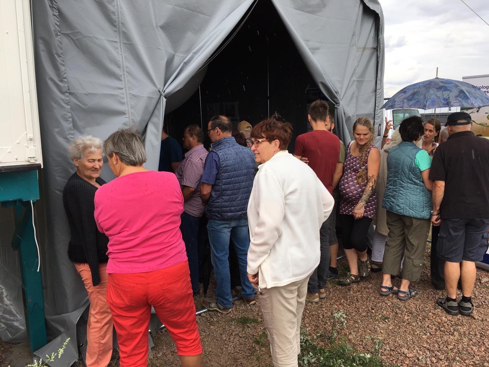
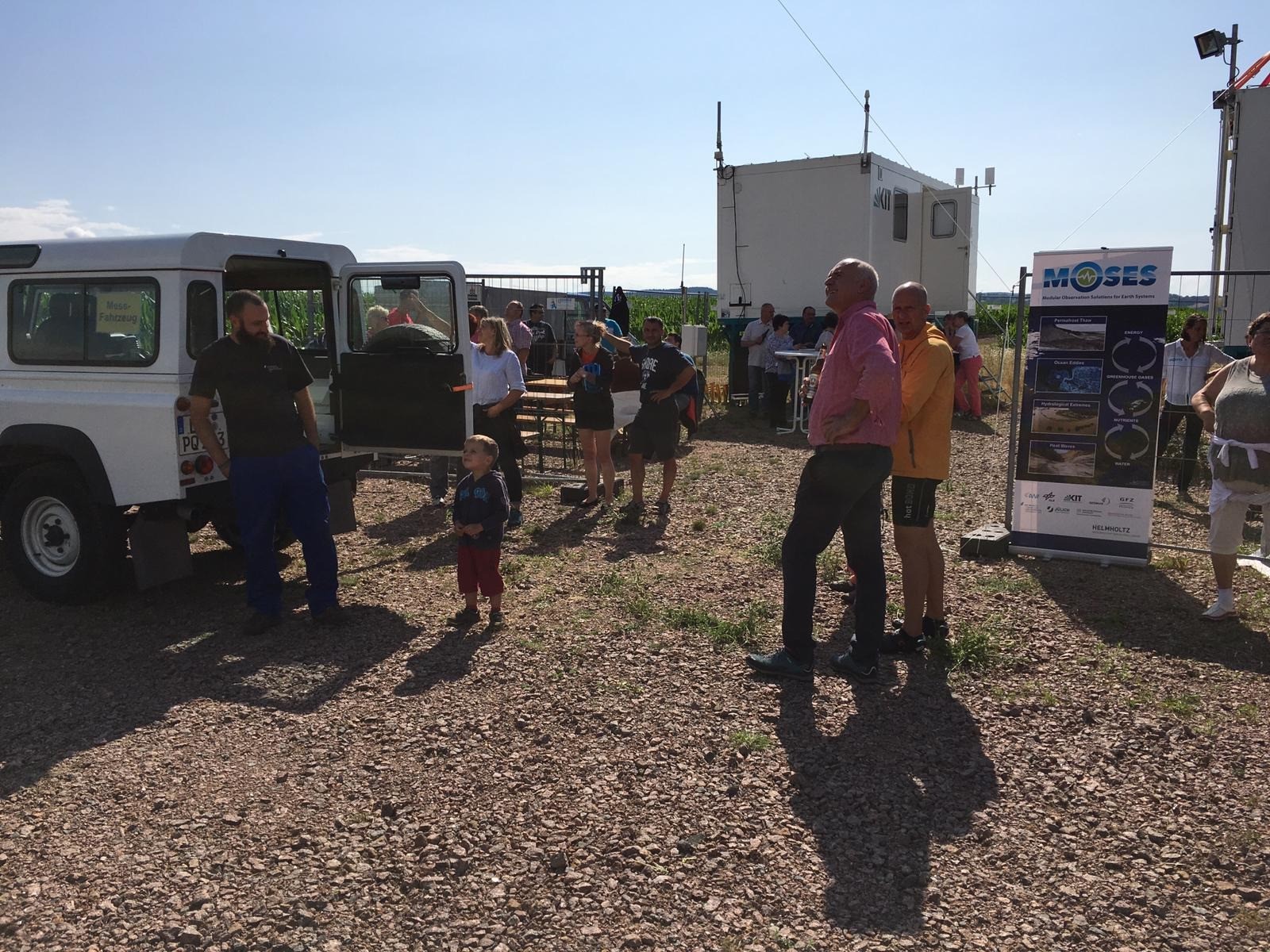
An open day for the local population on July 21st, 2019 at the KITcube main site in Dittersdorf closed the Müglitz 2019 campaign.
 |
 |
 |
 |
KITcube main site during the MOSES Müglitz campaign 2019 at Dittersdorf, eastern Erzgebirge, Saxony. Top left: Assembly and installation of KITcube in April 2019, top right: thunderstorm event with heavy precipitation including hail on June, 12th. bottom row: Open day on July 21st.
 NaFoLiCA (2017)
The modular concept of KITcube was exploited for measurements in Namibia and Germany at the same time in 2017.
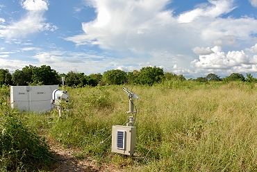
Namib Fog Life Cycle Analysis – NaFoLiCA
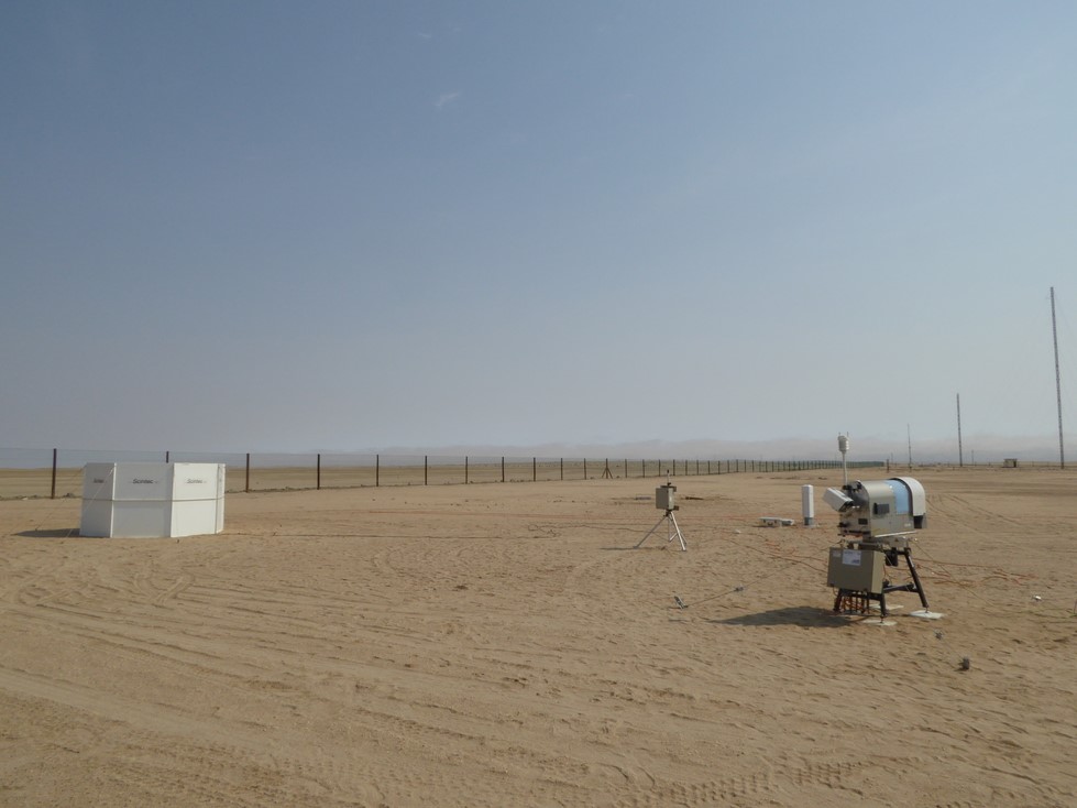
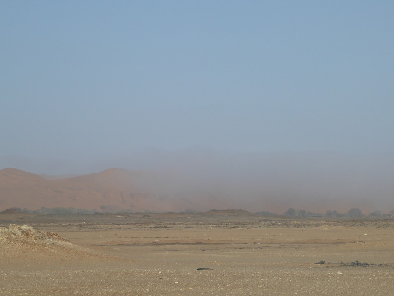
The Namib desert is one of the driest region on earth. Fog is the most important source of water there and influences the spatial distribution of flora and fauna. The knowledge about spatial and temporal patterns in the fog distribution and the amount of fog water deposition is hardly known. The aim of Namib Fog Cycle Analysis (NaFoLiCA) is an improved understanding of the fog dynamics in this region. To gather the required measurements, parts of KITcube were operated in Namibia in September and October 2017.
 |
 |
|
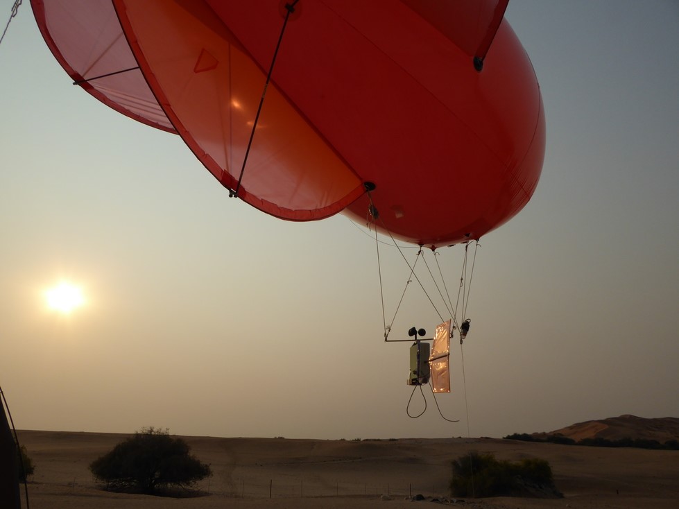
Left: A sodar (background, left), an aerosol spectrometer (background, central), and a microwave radiometer (foreground) deliver wind-, temperature-, humidity- and aerosol observations at Coastal Met (near of Walvis Bay, about 10 km east of the Atlantic). Right: Fog boundary between the coast and Gobabeb
|
|
 |
 |
|
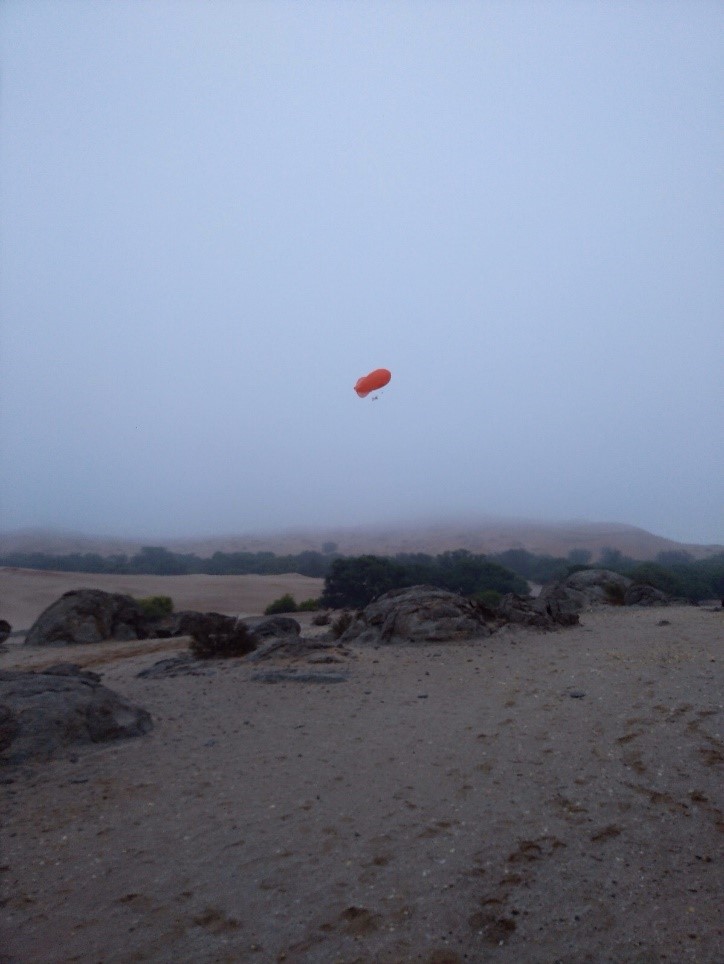
Tethered balloon ascends at Gobabeb research and education centre about 55 km east of the Atlantic. |
|
![]() [UC]2 - Urban Climate Under Change (2017-2018)
[UC]2 - Urban Climate Under Change (2017-2018)
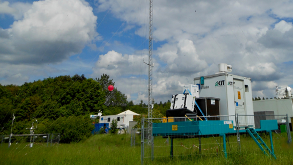
The program “Urban Climate Under Change - [UC]²" aims at the development, validation and application of building-resolving urban climate models for entire cities. Within joint research projects ‚Three-dimensional Observation of Atmospheric Processes in Cities (3DO) “High-resolution urban wind fields and city-surroundings exchange processes” are investigated to improve understanding of the following items: (a) horizontal structure of intra-urban horizontal wind field patterns, (b) vertical structure of Urban Boundary Layers (UBLs), (c) superimposed secondary circulation systems, (d) exchange between the UBL and the lower free troposphere with respect to momentum, heat, humidity and atmospheric pollutants and (e) provision of respective evaluation data for urban climate models. KITcube continuous measurements are taking place in the city of Stuttgart in 2017 and 2018 including 2-month duration intensive observation periods during winter and summer each year. Measurements in Stuttgart within the BMBF Program Urban Climate Under Change [UC]² are ongoing in 2018.
 |
 |
 |
 |
|
HATPRO microwave temperature and humidity profiler (top left) and Windcube Doppler-lidar (top right) in Stuttgart city centre on top of the town hall. Two WindTracer Doppler lidar systems were installed in the vineyards of Stuttgart for coordinated dual Doppler operation (bottom left + right), together with the X-Band radar (bottom right) to study local flow systems, and modifications of precipitation patterns by urban areas. |
|
WASTEX WASTEX - Wind And Storm Experiment (2017)
Wind gusts are responsible for most of the damages in cyclonic winter storms, the most destructive natural hazards over central Europe. Their forecast is challenging, because they involve multiple scales from the track and intensity of the storms down to turbulent momentum transport. Observations and forecasts are investigated here to gain an insight into the dynamics and predictability of gusts at subsynoptic scales. The field campaign WASTEX (Wind And STorms EXperiment) within the DFG Transregio 165 “Waves2Weather” framework was conducted during winter 2016/17 near the city of Karlsruhe.
The WindTracer HYB Doppler lidar and a MFAS sodar provided high-resolution observations in space and time within a range of several km during the passage of low-pressure systems.
 |
 |
WindTracer HYB Doppler lidar and MFAS sodar during WASTEX on top of a small hill “Energieberg” in the western part of Karlsruhe waiting for the next storm event.
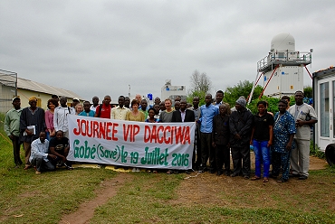
![]() DACCIWA (2016)
DACCIWA (2016)
Dynamics-Aerosol-Chemistry-Cloud Interactions in West Africa - DACCIWA
Goal of the interdisciplinary DACCIWA project is to investigate the influence of the rapid increase of air pollution associated with explosive population growth, urbanisation und economic growth on respiratory diseases, agriculture, and cloud and precipitation formation during the West African summer monsoon. So far, the influence of manmade pollution on weather and climate is unknown due to a lack of observations and process understanding. DACCIWA aims to close this gap by gathering invaluable data during a large field and aircraft campaign in summer 2016, which will help to improve our understanding in aerosol-chemistry-cloud-precipitation formation and its representation in weather-chemistry models.
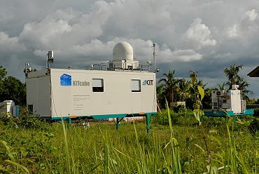
KITcube was deployed to Savè in Benin to conduct measurements during the monsoon period in June and July. The site was operated jointly together with our partners of University of Toulouse with main focus of on identification of meteorological controls on the whole process chain from the formation of nocturnal stratus clouds, via the daytime transition to convective cloud, and the formation of deep precipitating clouds. KITcube infrastructure was the base for interconnecting instruments, exchanging data and communication at the measurement site.
During the campaign, the first time cloud and aerosol profiles were derived from KITcube measurements applying the cloudnet program suite directly on site. We gratefully thank Ewan O’Connor!
Two movies – one realized by the film teams of KIT and University of Toulouse https://www.youtube.com/watch?v=zjDrEvTmZt8 and another by Arnauld Mansat https://vimeo.com/184522021 illustrates the scientific work and logistic challenges of such a field campaign.
 |
 |
 |
 |
VIP day at the Savè measurement site with guest from Ministries, Research Institutions, Weather services and local administration (top left). KITcube office container with connected cloud radar, X-Band radar, Doppler lidars and cloud cameras (top right), sodar, microwave profiler and Aeronet photometer (lower left) and during a flow visualization experiment next to the X-Band radar (lower right).
![]() DESERVE (2014)
DESERVE (2014)
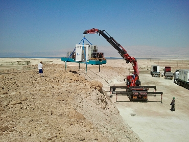
Dead Sea Research Venue - DESERVE
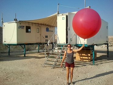
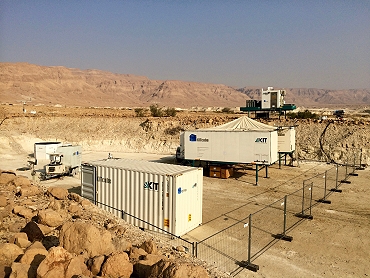
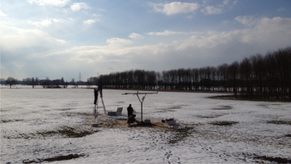
The Dead Sea region faces big water-related challenges. Among them are sea level decline, desertification, flash floods, ascending brines polluting freshwater, sinkhole development, and the repeated occurrence of earthquakes. Climate change and extensive exploitation of groundwater and surface water even aggravate the situation. These challenges can only be mastered in an interdisciplinary research effort involving all riparian countries. DESERVE is designed as a cross-disciplinary and cooperative international project of the Helmholtz Centers KIT, GFZ, and UFZ with well-established partners of the riparian countries. Within DESERVE, the research of IMK-TRO focuses on the operation of a long-term meteorological monitoring network with several meteorological stations in combination with intensive special observation periods with KITcube, and numerical modelling. Within DESERVE KITcube was operated at a site close to MASADA, Israel with branches on the opposite side of the Dead Sea in Al Masra.
 |
 |
 |
 |
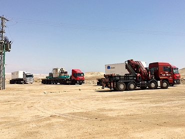
| Arrival of KITcube (top left) in the Desert at Masada and installation of the WindTracer HYB Doppler lidar. Radiosonde launch and KITcube main site at Masada (lower images). | |
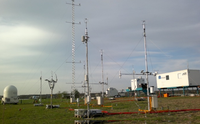
![]() HD(CP)² (2013)
HD(CP)² (2013)
High Definition Clouds and Precipitation for advancing climate prediction - HD(CP)²
The HD(CP)² Observational Prototype Experiment (HOPE) was performed in April and May 2013. For this field campaign KITcube was installed in the vicinity of Forschungszentrum Jülich. The unique approach of the measurement campaign was the density of the measurement network: Within less than 5 km distance two other measurement systems were installed and operated the universities of Cologne and Bonn, by MPI for Meteorology as well as by TROPOS in Leipzig. Instruments at these locations were for example microwave radiometers, wind profilers as well as cloud and X-Band radars. Research goals of IMK during HOPE were on the one hand the determination of the energy balance components at the land surface, additionally considering nearby stations of the TERENO project and on the other hand the investigation of the structure of turbulence in the boundary layer. Therefore, one of the WindTracer Doppler-lidars was located about 3 km west of the main KITcube supersite together with a second energy balance station. Using Dual Doppler techniques, coherent structures were detected in the horizontal wind field. Moreover, this measurement setup allows for simultaneous observations of turbulence profiles at multiple locations. At the KITcube supersite, two additional lidar systems were installed and operated by the University of Hohenheim, measuring temperature and humidity in the boundary layer with high temporal resolution. By combining these measurements with Doppler-lidar wind measurements of KITcube, vertical profiles of turbulent fluxes can be determined. The profiles derived in this way are an important contribution for the validation of LES performed within HD(CP)².
 |
 |
 |
 |
Arrival of KITcube (top left) and installation of an energy balance station (top right). Doppler lidar WindTracer HYB and Windcube 200s at the “Wasserwerk” site next to the energy balance and turbulence tower (lower left). KITcube main site Hambach with HATPRO wind and temperature profiler, radiosonde station, 30m profile tower, energy balance and turbulence towers, WindTracer WTX and Windcube WLS8 and WLS7 Doppler lidars as well as water vapour DIAL of University of Hohenheim.
![]() HyMeX (2012)
HyMeX (2012)
Hydrological Cycle in the Mediterranean Experiment – HyMeX
Within the framework of the Hydrological cycle in Mediterranean Experiment (HyMeX) and the first special observation period (SOP 1) was conducted in autumn 2012 in the western Mediterranean. HyMeX aims to improve the understanding and quantification of the hydrological cycle and related processes in the Mediterranean with emphasis on high-impact weather events, inter-annual decadal variability and associated trends in the context of global warming. During SOP 1 KITcube was positioned at one of HyMeX's supersites on the island of Corisca. The deployment of KITcube at this position allowed to study the impact of the mountainous island on initiation and modification of isolated deep convection and provided upstream conditions for the intense precipitation events affecting continental south-eastern France and northern and central Italy. The KITcube instruments were deployed at two main sites: one at Corte in the Tavignano Valley in the center of the island and one at San Giuliano on the east coast.
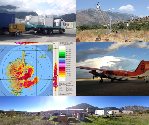
Arrival of KITcube at Corté site in central Corsica (top left) and installation of the 24 m profile tower (top left). X-Band measurements during a thunderstorm event (middle left) and research aircraft Dornier 128 D-IBUF (middle right). Panoramic view of the KITcube site at Corté (lower image).
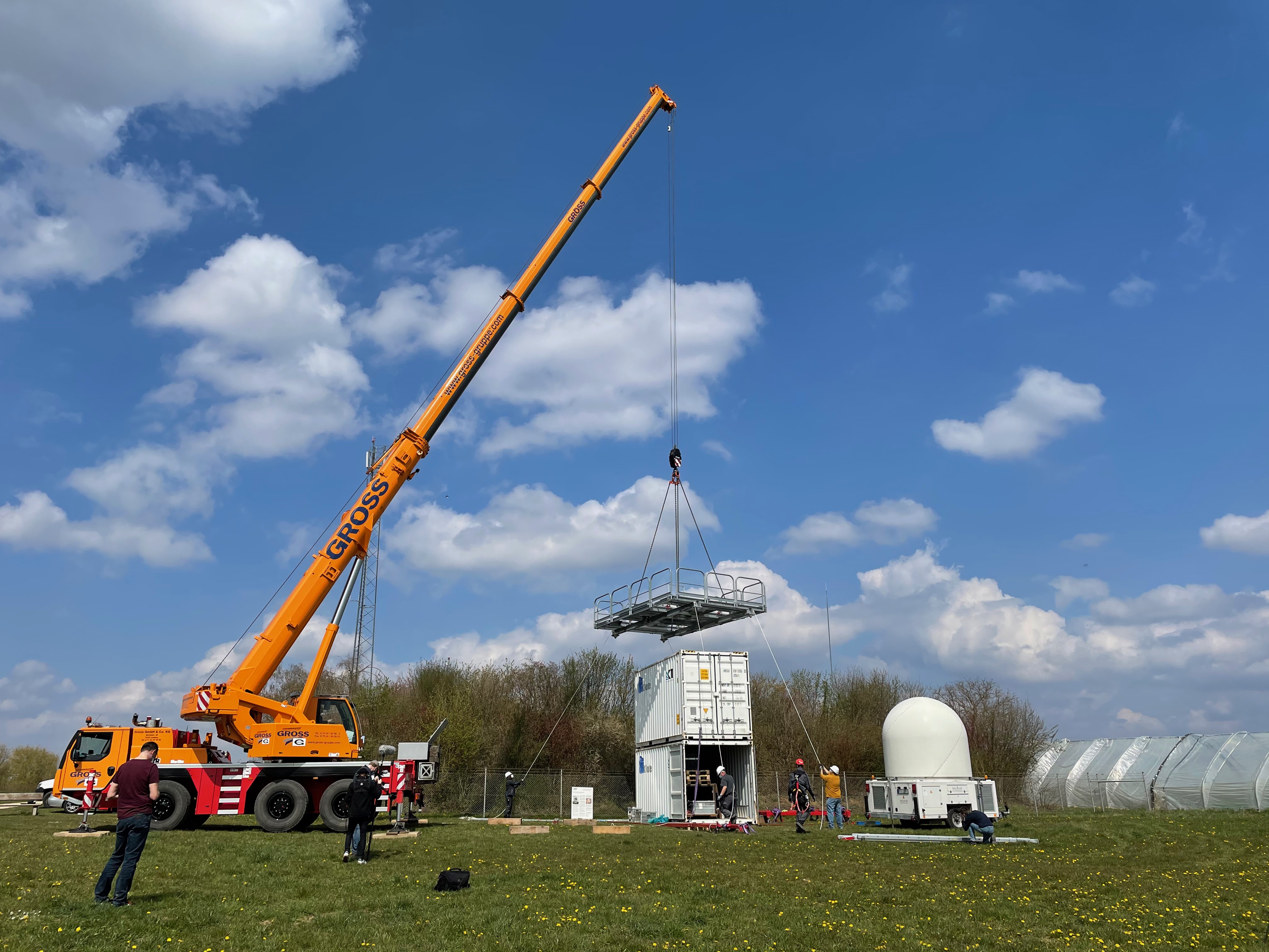
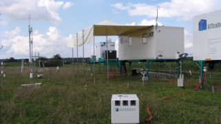
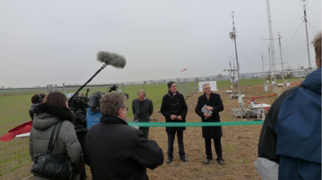
 First KITcube Deployment (2010)
KITcube built up
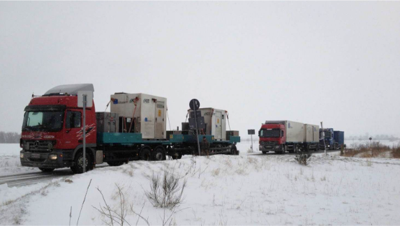
A first set-up and measuring phase with KITcube took place between 2010 and 2011 in the palatinate village Hatzenbühl. Thereby all measuring systems as well as the central data acquisition and processing were operated together the first time. This opportunity was also used to celebrate an opening ceremony with the Presidential Committee of the KIT.
 |
 |
 |
|